To be listed on the CAMPOSOL TODAY MAP please call +34 968 018 268.
The Camino de Levante pilgrimage and hiking route from Orihuela to Caravaca de la Cruz
The 120-kilometre walk is open permanently and attracts thousands of religious pilgrims every seven years
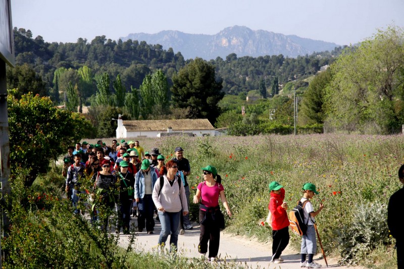 The Camino de Levante is a walking or cycling route which covers a distance of approximately 120 kilometres between Orihuela, in the south of the province of Alicante, and Caravaca de la Cruz, in the north-west of the Region of Murcia.
For much of this distance the Camino de Levante runs along other routes, the most important of them being the Vía Verde del Noroeste greenway between the regional capital of Murcia and the final destination in Caravaca. However, it also includes various additional sections at the start of the walk and a series of optional urban detours, most of them taking walkers to other sites of a religious nature.
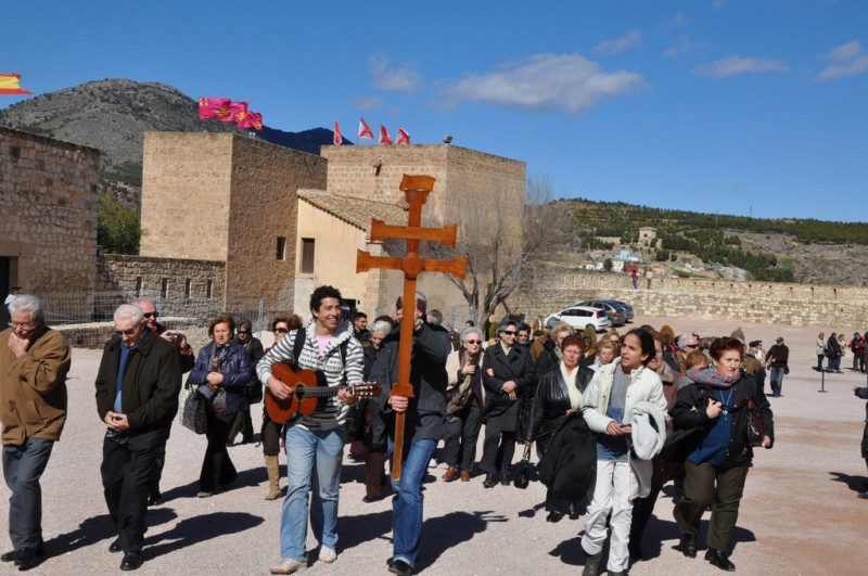
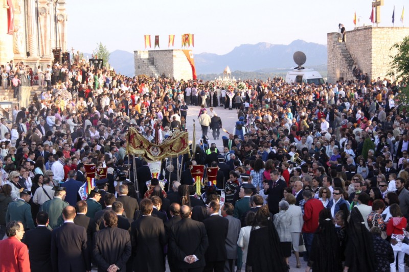
This emphasis on the Catholic faith is explained by the fact that the Camino de Levante has been designed as a pilgrimage route to the city of Caravaca de la Cruz, where a Holy Jubilee is held every seven years: this enables those who complete the journey to the Basilica-Sanctuary of Caravaca to venerate the “lignum crucis”, or fragment of the cross on which Jesus Christ was crucified, which is kept there in a reliquary, the Cross of Caravaca. At the same time, by collecting sufficient stamps on their “Credencial del Peregrino” (a kind of Pilgrim’s ID card), visitors are able to attend a Pilgrimage Mass and receive plenary indulgence, which equates to a complete pardon for sins committed and the cleansing of the soul from attachment to anything but God.
In the three Jubilee Years held so far numerous pilgrimage routes to Caravaca de la Cruz have been created, but in 2017 it is the Camino de Levante which is being promoted as the main way to reach the holy city.
For many, then, the Camino de Levante is a route of religious pilgrimage, but as is the case with the Camino de Santiago which leads to Santiago de Compostela in Galicia, in the north-west of Spain, a large number of those who undertake the walk do so for reasons other than religious piety and plenary indulgence. Perhaps more than anything, the Camino de Levante is an attractive and interesting way to see and learn about the Region of Murcia, its people, its food and drink, its landscapes and its history, and in the six years between Jubilees it is not put away and placed in storage until it is next needed!
The route exists permanently, and although the Jubilee Year is in some ways the best time to tackle it – there is more company along the walk, and more establishments taking part by providing special offers for pilgrims - in other years it remains one of the most attractive ways to explore some of the inland areas of the Region of Murcia.
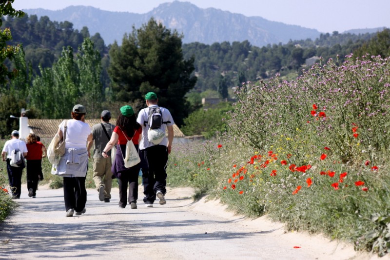
The route of the Camino de Levante
The Camino de Levante is divided for convenience into five stages, although walkers and pilgrims are of course not obliged to cover the full stage distance in one day, or indeed to complete the whole route in five days. A popular option is to tackle short distances of 5 or 10 kilometres at a time, which makes it possible to enjoy the sights and detours along the way, as well as a hearty lunch, without the pressure (and fatigue!) which can result from feeling obliged to reach a destination over 20 kilometres away.
The five stages of the Camino de Levante are as follows:
1. Orihuela to Murcia along the Banks of the River Segura (24 km): this flat stage takes walkers on a journey between two cities rich in history, through the fertile farmland of the flood plain of the River Segura. The stage begins at the church of Santas Justa y Rufina in Orihuela and for much of the time follows the banks of the Segura, passing wide expanses of flat land where the vegetables for which the “huerta” of Murcia is famous are grown.
The route crosses under the Tajo-Segura water supply canal shortly before passing Beniel, and then reaches El Raal, from where the monumental statue of Christ in Monteagudo signals that the regional capital of Murcia is not far away. Walkers (and riders) enter the city by passing the districts of Alquerías, Santa Cruz, Llano de Brujas and Puente Tocinos.
2. Murcia to Alguazas, still in the “huerta” (26 km): this section of the Camino de Levante crosses another wide swathe of the “huerta”, first following the “Malecón” riverside path on its way out of Murcia and then passing Rincón de Sota and Puebla de Soto and heading for the historic water wheel which has been preserved in La Ñora.
The wheel and the irrigation ditches (“acequias”), many of which date from the Moorish occupation of Murcia which ended in the 13th century, are a reminder of the importance of water to the agriculture of the area.
The route then follows the Segura past Javalí Viejo, Javalí Nuevo, Ribera de Molina and Torrealta before the next stop in Molina de Segura at the church of Nuestra Señora de la Consolación, and from there the path joins the old railway line towards Alguazas.
3. Alguazas to Mula, through the badlands and into castle territory (26 km): the Camino de Levante now leaves the “huerta” and heads towards the north-west of Murcia, first crossing the “badlands”, a harsh and hostile landscape formed by water erosion between Alguazas and Mula. Make sure you have plenty of drinking water as you enter this barren landscape!
After a long stretch without passing any towns or villages there is a detour to Los Rodeos and Campos del Río, with its typical village houses and special charm, and from there to the church of Nuestra Señora de los Remedios in Albudeite.
Not far past Los Baños de Mula another detour allows the walker to see the Roman villa of Los Villaricos, after which the route heads to La Puebla de Mula and Mula itself.
4. Mula to Bullas, onto higher ground and vineyards (21 km): the walking becomes more strenuous now, as the route climbs to higher ground: the Mula stage rose to 300 metres above sea level, and now the terrain rises another 300 metres to the area of Bullas, famed for its wine production.
Along the route is El Niño de Mula, a village named after an apparition of the Infant Jesus which occurred in 1648, and the local fiestas commemorate the event every September.
Once in Bullas, having crossed a large expanse of open countryside, take some time to see the church of Nuestra Señora del Rosario and the Museo del Vino (wine museum).
5. Bullas to Caravaca, the end of the journey (21 km) : this is the hilliest and the hardest stage of the Camino de Levante, although on flat sections it follows the old railway line, this time leading to the Taibilla water supply canal, and then, flanked by vineyards and pine woods, to the spot known as Cristo Carrascalejo.
Shortly before arriving in Caravaca, when the destination is already in sight, the walker arrives in Cehegín, with its historic old centre and, just outside the town, the ruins of Begastri, an ancient Roman city which was the seat of a Diocese between the 6th and 8th centuries.
From there, it’s on to Caravaca, to the Santuario de la Vera Cruz on the hill behind the city and the end of the Camino de Levante.
Practical considerations on the Camino de Levante
Where to stay
On pilgrimage routes of this kind the most commonly sought after accommodation is usually the “cheap and cheerful” hostel, or “albergue”, and there are 14 of these affiliated to the Camino de Levante in the Jubilee Year of 2017. However, while many of them are actually on the route itself – this is the case, for example, in Alguazas, Campos del Río, Albudeite, Mula, Bullas, Cehegín and Caravaca – others are a fair distance away.
In the city of Murcia, to cite one instance, the youth hostel is actually in the outlying district of La Alberca, which is convenient for those visiting the Sanctuary of the Virgen de la Fuensanta as an extra on their way to Caravaca, but is unlikely to appeal to anyone who has just completed a 24-kilometre walk from Orihuela and is facing more of the same the following day.
But there are various alternatives among the establishments affiliated to the Camino de Levante. In the case of hotels the city of Murcia offers well over 20 to choose from, and there are others all along the route, and there are also tourist apartments available in and around Murcia, Los Baños de Mula, Bullas, Cehegín and Caravaca. In addition, there are holiday apartments in Murcia, Bullas and Cehegín, campsites in Alcantarilla and Bullas, and a host of country cottages and similar properties forming part of the Camino de Levante in 2017.
In the case of the last category, it is again important to choose carefully, as many of the properties are located some distance from the route of the Camino de Levante. While this might be considered advantageous by those who are looking to explore the Region of Murcia, it is clearly not desirable for those attempting to complete the route in 5 days!
The albergues can be booked via hotel booking systems, many Murcian travel agents will offer a booking service for hotels along the route or the Murcia region has compiled a webpage and app which aims to direct travellers to their options along the route: caminodelacruz.com.
Where to eat
The list of businesses affiliated to the Camino de Levante in 2017 includes well over 100 bars and restaurants, the majority of them in and around the city of Murcia, and walkers and cyclists certainly have no excuse for going hungry as they make their way towards Caravaca!
While Murcia obviously offers plenty of choice regarding where to eat, as the Camino de Levante heads north-west the options are fewer, and are concentrated far closer to the actual pilgrimage route than in the regional capital. Nonetheless there are still options in every town along the route, and of course others exist which are not officially affiliated to the Camino de Levante.
Apart from restaurants, the long list of affiliated businesses also includes wineries in the D.O.Bullas area, and even bakeries and other food stores at which weary travelers are welcome to stop and purchase sustenance: these establishments all offer discounts to those who present their Pilgrim’s “Credencial”.
What to see along the Camino de Levante
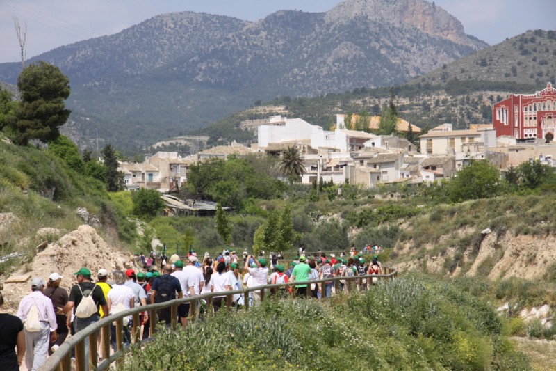
As the Camino de Levante makes its way towards Caravaca de la Cruz there are dozens of monuments, museums and interpretation centres signposted, all of them of interest not only to religious pilgrims but also to anyone keen to learn about the Region of Murcia and see the sights.
No list of such sites is ever completely exhaustive, though, and further information can be found in the town sections of Murcia Today.
Help and medical services on the Camino de Levante
The pilgrimage to Caravaca de la Cruz might be a spiritual experience for many, but the “real world” doesn’t cease to exist even for pilgrims, and official or medical help may become necessary at any time. For this reason the locations signposted along the Camino de Levante include Town Halls, tourist information offices, medical centres and hospitals, all of which are able to provide assistance in various kinds of emergency.
Walking the Camino de Levante in Jubilee Year
The Camino de Levante is a series of connected footpaths (also apt for cyclists and those travelling on horseback) which are open to the public permanently, and it is therefore possible for anyone to tackle either all or part of the route whenever they choose. However, in Jubilee Years most “pilgrims”, whether they are taking part for religious or other reasons, prefer to obtain the official “credencial” document, which acts as a kind of ID card or passport along the route and enables official stamps to be collected at various points along the way.
Other “Camino de la Cruz” pilgrimage routes leading to Caravaca de la Cruz include the following:
The Camino de Roncesvalles: a walk which leads to Caravaca all the way from Pamplona in Navarra, joining the Camino de la Cruz with the Camino de Santiago. From Navarra the Camino crosses the regions of Aragón, Valencia and Castilla-La Mancha, covering a distance of some 900 kilometres.
The Camino del Apóstol: this walk starts in the port of Cartagena, in the south of the Region of Murcia, where some believe that Santiago (Saint James the Apostle), the patron saint of Spain, arrived in the Iberian Peninsula shortly after the death of Christ. It covers 158 kilometres, and joins the Camino de Levante in Murcia.
The Camino de Lignum Crucis: this is a route which starts in the small Alicante town of Granja de Rocamora, and offers two options: one is to head directly towards Orihuela via Redován and Callosa de Segura before joining the Camino de Levante, while the other takes a picturesque northerly loop through Abanilla, El Rellano and Ulea before joining the Camino de Levante in Campos del Río (14 kilometres short of Mula).
The Camino del Altiplano: this 130-kilometre route starts in Yecla, in the north of the Region of Murcia, and passes through Jumilla, Calasparra and Moratalla on the way to Caravaca.
The Camino del Bajo Guadalentín: this is the route for walkers heading to Caravaca from Mazarrón. The 117-kilometre journey passes through Totana before climbing into the mountains of Sierra Espuña, stopping off at the villages of El Berro and Casas Nuevas before joining the Camino de Levante in Bullas.
The Camino del Alto Guadalentín: this takes walkers from the south-westernmost point in the Region of Murcia, in Águilas, on a four-stage route via Pozo de la Higuera, Lorca and Zarzilla de Ramos.
The Camino de Andalucía: this 45-kilometre route approaches Caravaca from the west, beginning in the mountains on the boundary with Andalucía.
The Camino de San Juan: this route starts in Cañada de la Cruz, on the Camino de Andalucía, and takes a northerly circuit towards the Campo de San Juan and some of the highest ground in the Region of Murcia. It then rejoins the Camino de Andalucía between Archivel and Caravaca.
The Camino del Campo de Cartagena: a 136-kilometre route from the port city of Cartagena heading in an almost straight line which takes walkers through La Aljorra, La Pinilla and Totana before climbing into the foothills of Sierra Espuña and reaching Zarzadilla de Totana. It then crosses the plain in the north of Lorca, through Coy and La Encarnación, before reaching the Holy City of Caravaca.
Further information about Caravaca is available from the tourist office (Plaza de España, 7, telephone 968 702424, email turismo@caravacadelacruz.es).
For more local information, including the Holy Jubilee Year as well as local news and what’s on, go to the home page of Caravaca Today.


