


Temperatures warm up before midweek front arrives: Spain weather forecast Feb 16-19
The winds will gradually subside but new frontal systems will bring rain to the northwest of Spain from Wednesday

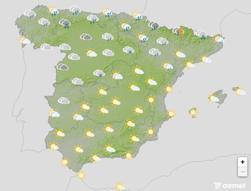
Weather outlook on Wednesday February 18
This week's kicked off with strong winds that are still lingering from Storm Oriana, although the good news is they're expected to ease off as the days go by. The storm is moving eastward but is still affecting the easternmost parts of the country as we head into Monday.
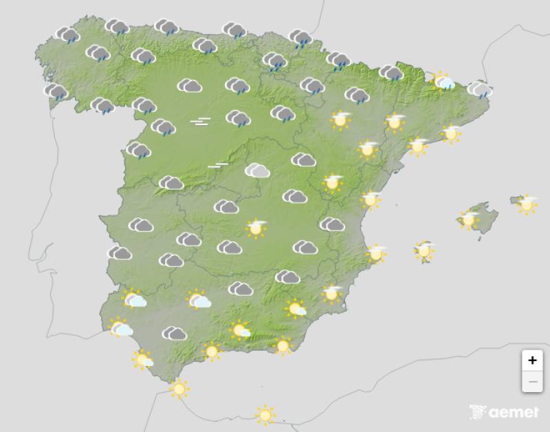
Weather outlook on Monday February 16
Throughout the week, new frontal systems are expected to arrive from the northwest, which means almost all the rain will hit the northwestern part of Spain rather than being spread across the country.
Storm Oriana has definitely been the main talking point over the weekend with its fierce winds, and we're starting the week with those same conditions, although they won't be quite as strong as they were on Saturday and Sunday.
By Monday February 16, Aemet's weather warnings have changed from orange and red to yellow, but they're staying in place because winds are still exceeding 70 kilometres per hour in many cases.
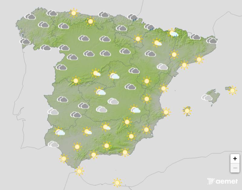
Weather outlook on Tuesday February 17
The regions most affected by the wind and intense waves will be those along the Mediterranean coast, running from Catalonia right on through the Valencian Community and Murcia to the Balearic Islands and Melilla. The yellow warning for strong winds and waves also remains in place along the entire northwest coast and in some inland areas.
The wind is making temperatures feel colder than they actually are, even though they've risen slightly. The chill over the weekend has been intensified in many areas by these winds, but as they subside, the air should soften and it'll feel less cold. In fact, throughout the week, except for a couple of days when fronts pass through, temperatures will remain milder.
High pressure systems have been stabilising the weather recently and the situation isn't like it was a few weeks ago with atmospheric rivers and heavy rainfall. However, the proximity of a low-pressure system to the northwest will increase instability by midweek.
Weather outlook on Thursday February 19
Between Wednesday February 18 and Thursday February 19, a front will move in from the northwest, bringing rain and snow to higher elevations and also generating more wind and strong waves, especially on the Cantabrian coast and northern Galicia. The most significant rainfall will be found in the northern third of Spain, from Galicia through Asturias, Cantabria and the Basque Country to the Pyrenees.
Snow accumulations are also expected in the Central and Iberian mountain systems and sparsely in areas of the Penibetic range and other mountains of eastern Andalucia, although at higher elevations.
The Canary Islands remain unaffected by this passing storm. What will dominate during the final stretch of the week is anticyclonic weather with clearer skies, but expect cold nights due to the absence of clouds in many areas.
For more weather news go to our Weather & Climate page or follow the Spain Weather Watch Facebook group for regular updates
Images: Aemet


Sign up for the Spanish News Today Editors Roundup Weekly Bulletin and get an email with all the week’s news straight to your inbox
Special offer: Subscribe now for 25% off (36.95 euros for 48 Bulletins)
OR
you can sign up to our FREE weekly roundup!
Read some of our recent bulletins:
Discount Special Offer subscription:
36.95€ for 48 Editor’s Weekly News Roundup bulletins!
Please CLICK THE BUTTON to subscribe.
(List price 3 months 12 Bulletins)
Read more stories from around Spain: