


Spain braces for another mid-week storm: Weather forecast Feb 10-13
The Azores storm will bring widespread rain to large parts of southern Spain this week

Weather outlook on Wednesday February 12
Spain is bracing itself for another week of bad weather with the arrival of a low pressure system from the Azores Islands that is set to hit on Tuesday and Wednesday, resulting in plenty of rain in the southwest of the country and right up along the coast as we head towards the weekend.
As the days go by though, the storm will lose intensity and the heavy rainfall should ease off into showers.
Monday February 10
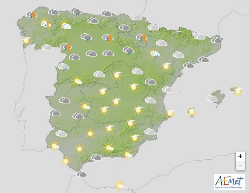
The worst of the weather will be confined to northern Spain on Monday and in the rest of the country, only cloudy intervals are forecast with some light drizzle in the Strait of Gibraltar.
Despite the rain, day-time temperatures should increase in the north while no significant changes are expected elsewhere. On the other hand, Monday night should be milder than the weekend, causing any frosts to recede.
Tuesday February 11
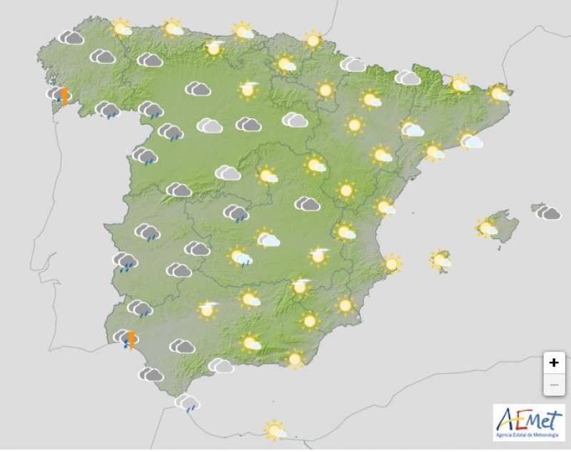
The Azores front will start moving in on Tuesday, resulting in overcast skies in the south and widespread rain in the west of the country. Here, day-time temperatures will fall but again, few changes are forecast elsewhere.
Wednesday February 12
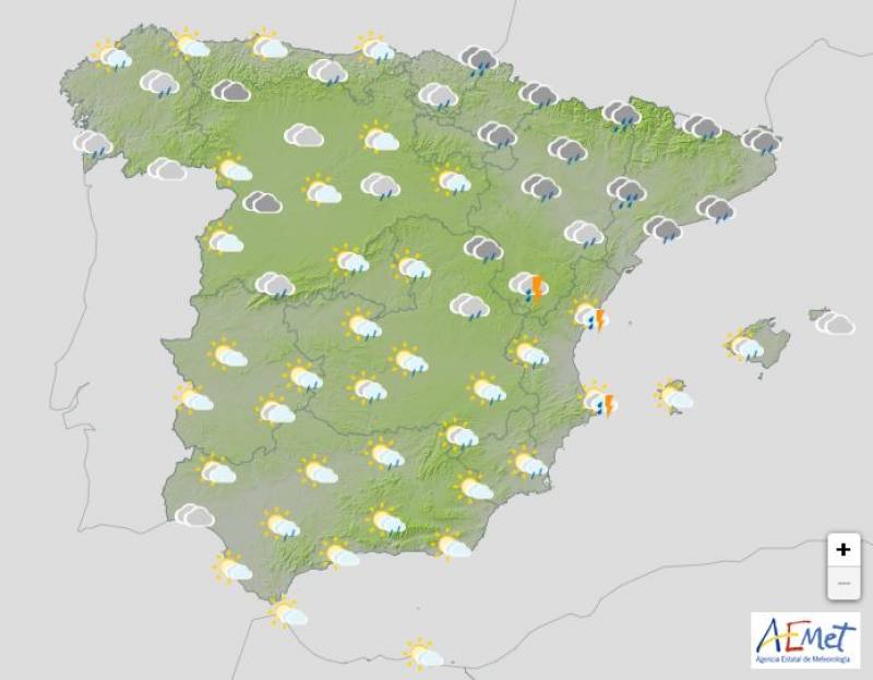
The storm will take hold by Wednesday as the front travels from the southwest, creating cloudy skies and heavy downpours in the entire country, with the exception of the southeast and the Balearic Islands.
Day-time temperatures will continue to drop in most areas, although it should remain quite mild on the Mediterranean coasts and on the islands.
Thursday February 13
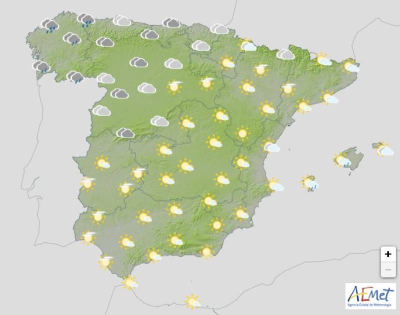
Thursday is expected to be a day of transition and although the forecast is still a little uncertain this far ahead, there’s a chance the weakening front could be reactivated. At the moment, abundant cloudiness is expected in the Balearic Islands and in the east of Spain. Some light rain is forecast in the Mediterranean, but this should ease off throughout the day.
In the late hours, the arrival of a new front will darken the skies in the northwest, leaving heavy rain in the west of Galicia.
Maximum temperatures will rise in the northeast, while no significant changes are expected in the rest of the country.
Join our Spain Weather Watch Facebook group for regular weather and climate change updates
Images: Aemet


Sign up for the Spanish News Today Editors Roundup Weekly Bulletin and get an email with all the week’s news straight to your inbox
Special offer: Subscribe now for 25% off (36.95 euros for 48 Bulletins)
OR
you can sign up to our FREE weekly roundup!
Read some of our recent bulletins:
25% Discount Special Offer subscription:
36.95€ for 48 Editor’s Weekly News Roundup bulletins!
Please CLICK THE BUTTON to subscribe.
(List price 3 months 12 Bulletins)
Read more stories from around Spain: