


DANA storms replace heatwave: Spain weather forecast August 21-24
Storms battering northern and inland Spain will likely spread to the rest of the country over the weekend
Weather outlook on Sunday August 24
Early in the week, the mercury finally started to drop, cloud cover set in and the rain returned with a vengeance. While the brunt of the storms have so far been confined to inland areas of eastern Spain, the State Meteorological Agency (Aemet) is expecting showers and some heavy rain to extend to other areas on Thursday.
The Atlantic front will settle down a bit on Friday and Saturday but by Sunday, the rain will likely return to the southeast.
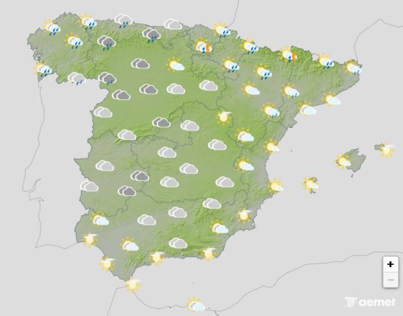
Thursday August 21
A severe storm will blast through northern Spain and the Balearic Islands on Thursday and while the heaviest of the rain will be confined, it could spread as far as the southeast in a lighter way. As the hours go by, cloud cover will develop across the country and while the forecast is rather uncertain, Aemet says this creates a chance of evening showers throughout.
Daytime temperatures will plummet in the southeast and rise in the west and northern Mediterranean.
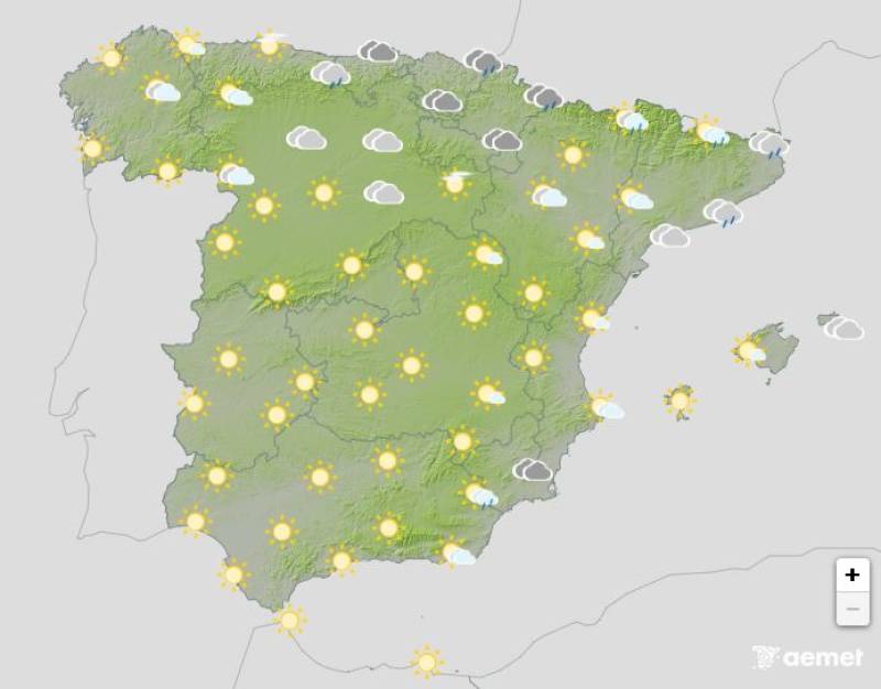
Friday August 22

The storm front will move away across the Mediterranean on Friday morning, stabilising the weather in most of the country. However, eastern Catalonia and the Balearic Islands can still expect overcast skies and thundery storms, and showers and occasional thunderstorms are also forecast in the Valencian Community. Elsewhere, it should remain clear and bright.
Maximum temperatures will fall along the Mediterranean coast and the eastern Balearic Islands, with slight to moderate increases predominating elsewhere.
Saturday August 23
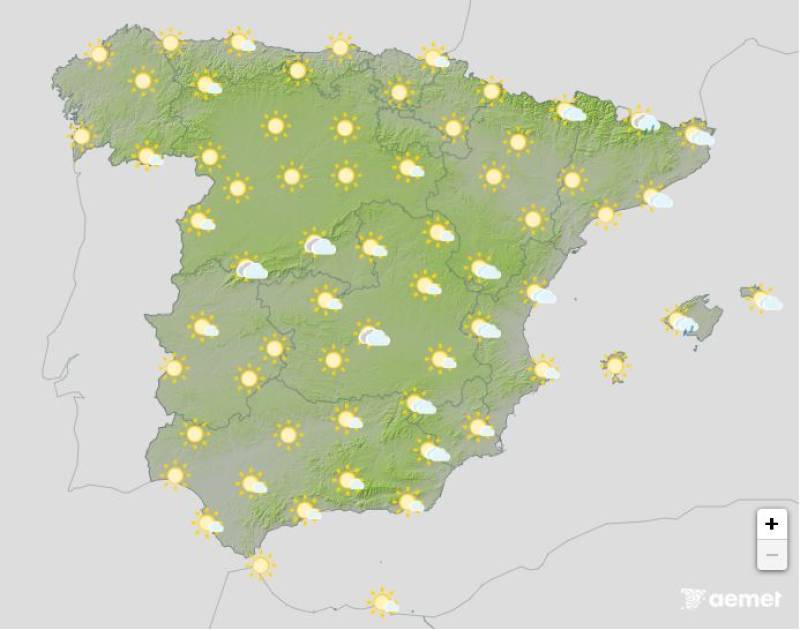
Saturday will be the most settled day of the weekend with mostly clear or slightly cloudy skies. However, the cloud cover could build later in the day in central and eastern Spain, resulting in scattered showers and the odd stormy interval.
Daytime temperatures will inch up across the board, exceeding 35ºC in large areas of the southern Atlantic coast.
Sunday August 24

The approach of another Atlantic front from the northwest will influence the weather in the Spain on Friday. Predominantly clear or mostly cloudy skies in the morning are expected to shift from west to east, which, with uncertainty depending on the front's development, will lead to overcast spells in the afternoon.
Though it’s far from certain, more storms and heavy rain are likely in the north and northeast.
Daytime temperatures will drop as the front passes through the west, but the mercury will rise along the Mediterranean coast and in the Balearic Islands.
Join our Spain Weather Watch Facebook group for all the latest weather and climate change updates
Images: Aemet


Sign up for the Spanish News Today Editors Roundup Weekly Bulletin and get an email with all the week’s news straight to your inbox
Special offer: Subscribe now for 25% off (36.95 euros for 48 Bulletins)
OR
you can sign up to our FREE weekly roundup!
Read some of our recent bulletins:
Discount Special Offer subscription:
36.95€ for 48 Editor’s Weekly News Roundup bulletins!
Please CLICK THE BUTTON to subscribe.
(List price 3 months 12 Bulletins)
Read more stories from around Spain: