


Beast from the East descends: Spain weather forecast February 6-9
Temperatures will plummet in large parts of Spain over the next couple of days

The Beast from the East, a term coined in Britain following the intense cold snap that hit Central Europe in 2018, has returned in the form of a freezing air mass from Russia. This weather front is set to sweep in just in time for the weekend and while it will result in plummeting, wintery temperatures in much of Spain, we’ll be spared the extreme conditions experienced seven years ago.
Meteorologically speaking, Spain won’t actually be hit by a ‘cold snap’, but it will be far more chilly and frosty over the weekend, particularly in northern and central Spain, and several provinces have already been issued with weather warnings as a result.
Thursday February 6
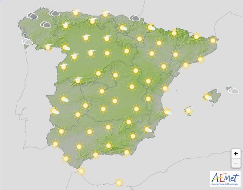
The weather across Spain will be incredibly varied on Thursday. While in much of northern Spain clear, bright skies will welcome the start of the day, clouds will begin to gain ground as the hours go by. In the Mediterranean, it will be the opposite: after an overcast, misty morning, the clouds will dissipate and the afternoon will be sunny and pleasant.
Both day and night-time temperatures will begin to fall, reaching just 14ºC or 15ºC in parts of Andalucía during the warmest hours.
Yellow weather alerts for low temperatures and/or fog have been activated in Aragon, Castilla y Leon, Castilla-La Mancha, Galicia and the Valencian Community.
Friday February 7
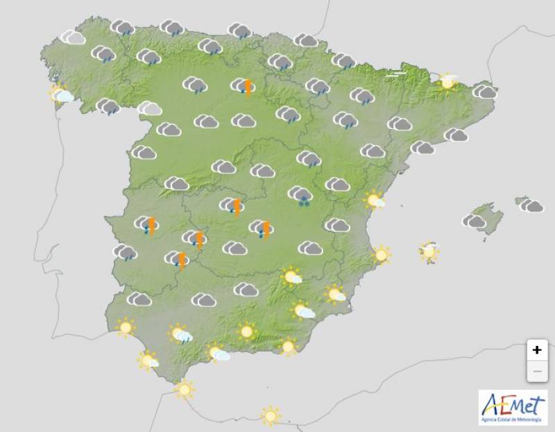
The weather will change abruptly on Friday with the arrival of a polar air mass that will result in a sharp drop in temperatures, accompanied by widespread rain and snowfall.
The north and centre of Spain will be the areas most affected by the arrival of an Atlantic storm, which will leave persistent rain in communities such as Galicia, Asturias, Castilla y León and Madrid. In addition, the wind will intensify considerably, with gusts that could exceed 80 km/h in some parts of the country.
Meanwhile, inland and in the south, temperatures will plummet, with values close to 0°C expected to be recorded in cities such as Madrid, Burgos and Soria.
Yellow weather alerts for snow have been activated in Aragon, Asturias, Cantabria, Castilla y Leon, Catalonia, Navarra and La Rioja.
Saturday February 8
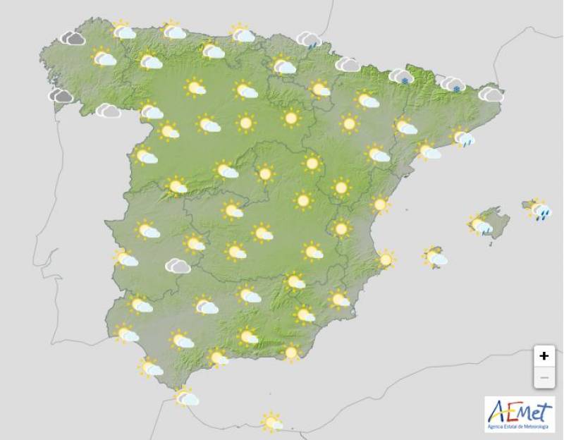
The weather should settle down a bit once the low pressure located in northern Spain moves towards the Mediterranean. While the forecast is still fairly uncertain, the State Meteorological Agency (Aemet) expects heavy rain in the mountains of the east and extreme south, along the Strait and in the Balearic Islands.
Day-time temperatures will creep up by a degree or two inland and along the east and southern coasts; values of 20-22ºC are expected to be recorded in the likes of Alicante and Murcia.
Yellow weather alerts for snow have been activated in Aragon, Catalonia and Navarra.
Sunday February 9
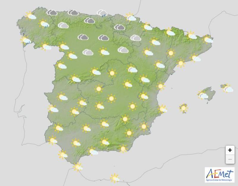
The stable weather should continue on Sunday, although the morning will be overcast due to the remains of Thursday’s front. Some rain is forecast in Galicia and the westernmost part of the country, but it should stay dry everywhere else.
After a chilly few days, the temperatures will rise across the board with the exception of the Mediterranean.
Join our Spain Weather Watch Facebook group for all the latest weather and climate change news
Images: Aemet


Sign up for the Spanish News Today Editors Roundup Weekly Bulletin and get an email with all the week’s news straight to your inbox
Special offer: Subscribe now for 25% off (36.95 euros for 48 Bulletins)
OR
you can sign up to our FREE weekly roundup!
Read some of our recent bulletins:
25% Discount Special Offer subscription:
36.95€ for 48 Editor’s Weekly News Roundup bulletins!
Please CLICK THE BUTTON to subscribe.
(List price 3 months 12 Bulletins)
Read more stories from around Spain: